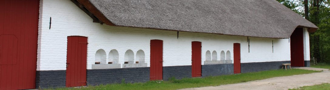

We’re sleeping in the loft of the shed and left the window open, so we wake up before six with the birds and the sun. It must have been a cold, clear night, because the grass outside is frosty instead of dewy and we have a great view of the change from black to blue with streaks of pink. We take it easy, take our time with breakfast (bread with choco paste and bananas) and are ready to leave before eight.
We were actually sleeping at the literal high point of our little trip at 100 m above sea level. I’ll admit that’s not very high, but I can assure you, you can do a lot of elevation gain/loss between 0 and 100 m. We’ll have a few hills to climb today, but overall we’ll be going down more often than up.

We put on all our available layers, in my case that’s cotton leggings, jogging pants, three woolly layers and a thick fleece, with the thickest wool socks ever and gloves too. We’re doing okay for now, mom’s not bothered at all, I’m a bit tired and my tailbone is a achy when I sit down, but it’s all very bearable and it’s a beautiful morning!
We briefly follow the trail of the old rail road – as we slept in a worker’s shed in the former train station of Racour, it passes right by our door. There’s no other cyclists or walkers yet, though we encounter a few commuter cars on the local roads when we pass them. We continue yesterday’s theme of tiny paths and mountain bike trails, often going straight up and down hills. Occasionally we see one of the numbered nodes of the bike route network, but we rarely follow them. The network sticks to asphalted roads, with the occasional wide gravel road thrown in for variation, and they’re often the least efficient route from A to B. Since we have to do quite some kilometres today, I’ve opted to pick the shorter paths. We’re really grateful it’s been dry for a week or so, it would have been much harder to get the heavy bikes over the rocks and roots of the small trails, if it had been muddy!
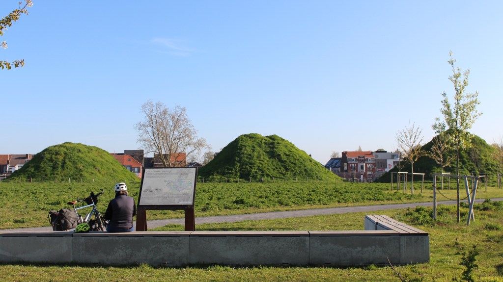
The approach to the town of Tienen is dominated by its industrial sky line and we recognize the Tiense Suiker symbol from far away. This sugar refinery uses beets and cane and is the most common sugar brand in Belgium. We’re about to swing into town when we see a marker showing the way to Drie Tumuli. I know tumuli is the plural for tumulus and that a tumulus is an old grave site and since I love ancient history, I convince mom (easily) to do the little detour and we take a strawberry snack break on one of the benches in the park.
It takes a bit of fiddling to put on/take off my helmet, since the clasp broke this morning. We created a replacement with one of the straps that we always carry as emergency equipment (I have a tiny roll of duct tape as well), so it’s safe, just not very easy. The off-roading really brought down our average speed, so we’re later than expected and we decide to buy our lunch here. We buy pastries and some smoked ham, we still have herbed butter and bread and m&m’s for dessert, should be great.
We tackle a big climb out of Tienen, then pass through Kerkom with its pretty castle and have an early lunch on top of the next hill, on one of the benches near a 150 old chapel to Our Lady of Scherpenheuvel, obviously a popular area since we see a few people out walking. The view is great, there’s a feeling of great satisfaction when looking down on a slope you just struggled to climb. We have our delicious lunch accompanied by the loud singing of birds, having to fend off the occasional curious dog (its owner just a little too far behind). We have a brief pit stop – no option to stop at a café for a drink and use of the toilet, so we donate some nitrogen and phosphorus to the local flora – and continue our straight line north-west.
The next hill up is a bit of a challenge: the path that looked doable on the OSM map turns out to be missing. We can see it on the map, but in reality there’s grass sloping up to a vineyard and there’s no room for a bike. We ask a local for confirmation and the next path over should be doable, though he warns us it’s not an easy road. We laugh it off, thank him kindly and start climbing. Another mountain bike trail – we actually encounter some bikers coming down – but the last bit is impossible to climb in the saddle: the combination of bumps, 7,5 % ascent grade and the weight of the bike is too much. By this point I’m pretty tired already and we do the last hundred meter or so on foot.

The worst / most fun bit is over: next we’re going to Aarschot, then we follow the rail road to Lier, mostly through quiet suburbs interspaced with fields for horses. My leg muscles have checked out and the tempo is pretty low now, we take regular breaks and ration our water. The route is a bit boring after all the off-roading, but at least it’s efficient. After Berlaar, we encounter road works again and have to detour: we pick the easy solution and following the steenweg Aarschot-Lier: these are busy roads, usually with two lanes in each direction, but they mostly have separate bike paths and are ruler-straight. We follow it a few kilometres to Lier, drive through the center and come out on the bicycle highway from Lier to Antwerp: almost home for me, though mom has to drive an extra 12 km to her home.
I come home exhausted, but that’s okay because I have nothing left to do except take a hot shower! My husband has aperitive and a drink waiting and an hour or two after dinner I fall asleep in the couch. Clean-up is for tomorrow.
Today’s statistics:
- distance today: 80.9 km
- elevation gain 462 m, loss 553 m
- max grade: 8.1 %
- riding time: 5h45
- average speed 14 kmph
