

Up at seven thirty today, though I woke up a few times before that (again). We’re close by a road with quite some traffic, plus we slept with the windows open to cool the room down, hence the hiccups.
We take our entire electronics stock down for breakfast: phone & tablet for organising the day, e-books for reading. Keeping everything charged requires some forethought, I can tell you. From the breakfast buffet, I limit myself to one bun with ham, cheese, cucumber and bell pepper, we’ll be out walking soon and should have the opportunity to buy/have lunch somewhere.
We decide to do one of the loops I prepared last week, through the Langerweher and Meroder forests. I’ve arranged it so we’ll pass two castles, abbey ruins and a biergarten for lunch. We park our car at the sports facilities, attempt to judge the weather and decide to anticipate the warmth of the sun: I’m wearing long shorts, then a tank top as a sublayer, a 200 g mid layer and a tshirt on top, all in merino wool. When it gets a bit warmer, I’ll take off the mid layer and can enjoy the sun on my arms.
We set off into the woods just before ten, following the Wikiloc trail I prepared. First stop is the Merode castle, which is in private hands (of the Merode family), but which you can admire from afar. We exit the village and tackle the forested slope behind it: we warm up quickly and take off a layer. Some of the paths we follow are forestry roads, recently used by giant machinery as evidenced by the deep thread-marks, others are narrow and seem barely used. On the map they look exactly the same, so we focus on distance and directly, rather than type of trail.
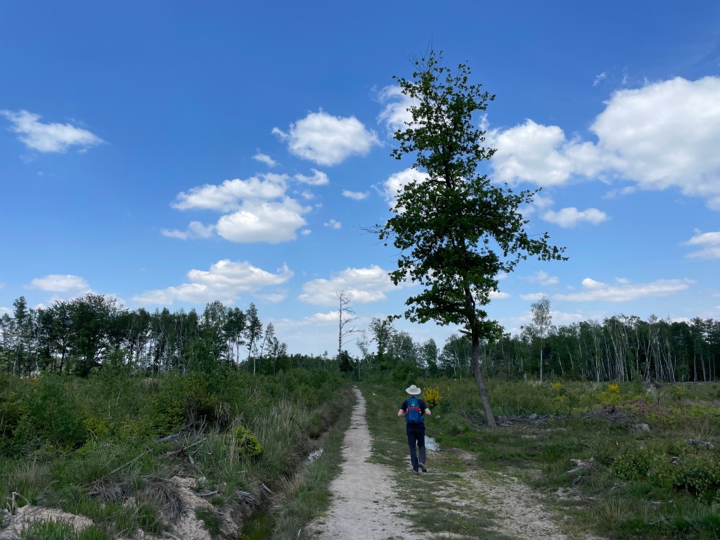

We deviate from the planned route pretty quickly, we’re early enough to take on a few extra kilometres before lunch and use the map to determine our route at every crossroads. We encounter very few people, but are surrounded by forest life: the birds are out and singing in great numbers. I use the newly installed Merlin app to sort out the songs into bird id’s. It’s hard to check the accuracy, since we can’t actually see any birds through the thick foliage, but some of them I already know from home and I recognise them by ear, and the results look pretty good.
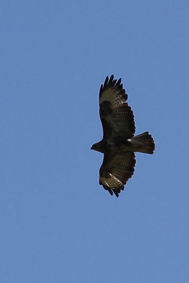
And so we make our way to our lunch spot: photographing plants, listening to birds, using apps to find out who’s who. We identified wood sage, wild garlic, a buzzard (didn’t need an app for that one), a spider wasp and a wolf spider. When we arrive at Laufenburg castle I am relieved to see my guess paid off. There is indeed a Biergarten here (literally: beer garden – they typically serve drinks and simple meals) and we’re early enough to have our pick of tables in the castle courtyard. We order wild boar sausage with potato salad and a cold coke for quick sugars. More people pop in, it looks to be a popular spot with the locals.


Upwards we continue, across the ridge to the next river valley. We’re supposed to find abbey ruins here, though they’re not evident from the hiking path. It takes us a moment to find a narrow foot path into the dense undergrowth, but when we fight our way through we find remnants of old walls scattered over an area of about a hectare. According to Wikipedia, it dates from the 14th C, was heavily damaged by fire in the 1830’s and then further destroyed in the second World War. Currently it’s completely overgrown and frankly unsafe, but quite picturesque.
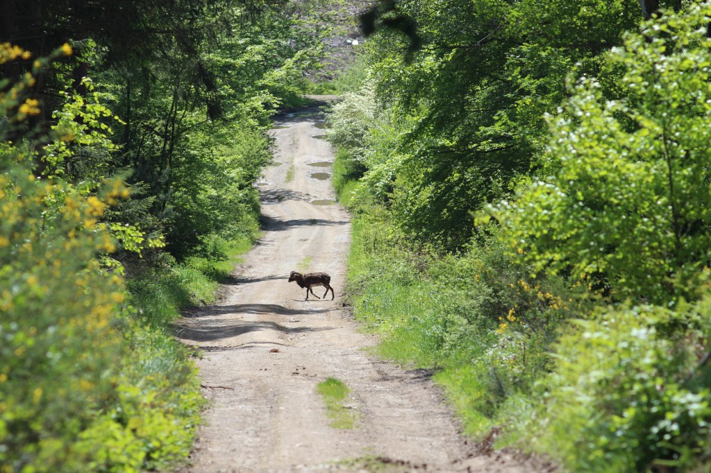
Only a long, slow descent still separates us from our car, though we deviate again from the planned route when the fancy takes us. The weather remains sunny, with a bit more wind than in the morning, but still warm enough for just a t-shirt. We see beech forests, birches and big open spaces where trees have been felled. Some of are even fenced, we suppose to protect the young trees recently planted. It’s not the most natural forest we’ve visited, but it’s nice to see how commercial forestry and nature conservation can coexist. We spot three mouflons crossing the road 100 ahead of us, as well as two insects we’ve never seen before: a broad-bodied chaser and something weird swimming in a shallow pond, possible a dragonfly nymph (ObsIdentify doesn’t know).
We end our loop around three, kind of tired but happy with the loop. It adds up to about 15 km, with 230 m of ascent. We stop in a grocery store on the way back (officially because the tube of tooth paste is almost finished, but also I really feel like a Kitkat), reserve a table at the Italian restaurant next to the hotel and generally relax. On top of the usual work of sorting pictures and writing the blog, I now also input all my animal photos in nature preservation apps, to find out what species they are exactly, but also so that the data can be used by conservationists. Fun!
